[vc_row][vc_column][vc_text_separator title=”Services”][vc_column_text] Global Water Resource Partners (GWRP), the water division of TRDA, offers a complete range of services to meet the critical water-resource needs in development, rights, and uses for water challenges in the new millennium. Whether for a rural-development project in Central Africa or a commercial application for a city in Iraq, we have established partnering relationships with some of the largest and most successful engineering and systems integration companies in the U.S. and abroad. This allows us to serve our clients efficiently and to compete effectively nationally and internationally. Following is a partial list of services we offer:
- Aquatic Biology
- Arid zone Studies
- Artificial Recharge
- Basin Studies
- Borehole testing
- Capture Zones
- Climate Change
- Computer Modeling
- Contamination & Remediation
- Contaminated Land Surveys
- Debris Flow
- Earth dams
- Ecological studies
- Environmental Assessment & Monitoring
- Environmental Studies
- Environmental Security
- Expert Testimony
- Flooding
- Flow and Solute Transport & Modeling
- Forensics
- Geochemistry
- Geostatistical Analysis
- GIS & Satellite Image Analysis
- Groundwater Studies
- Groundwater Monitoring, Modeling
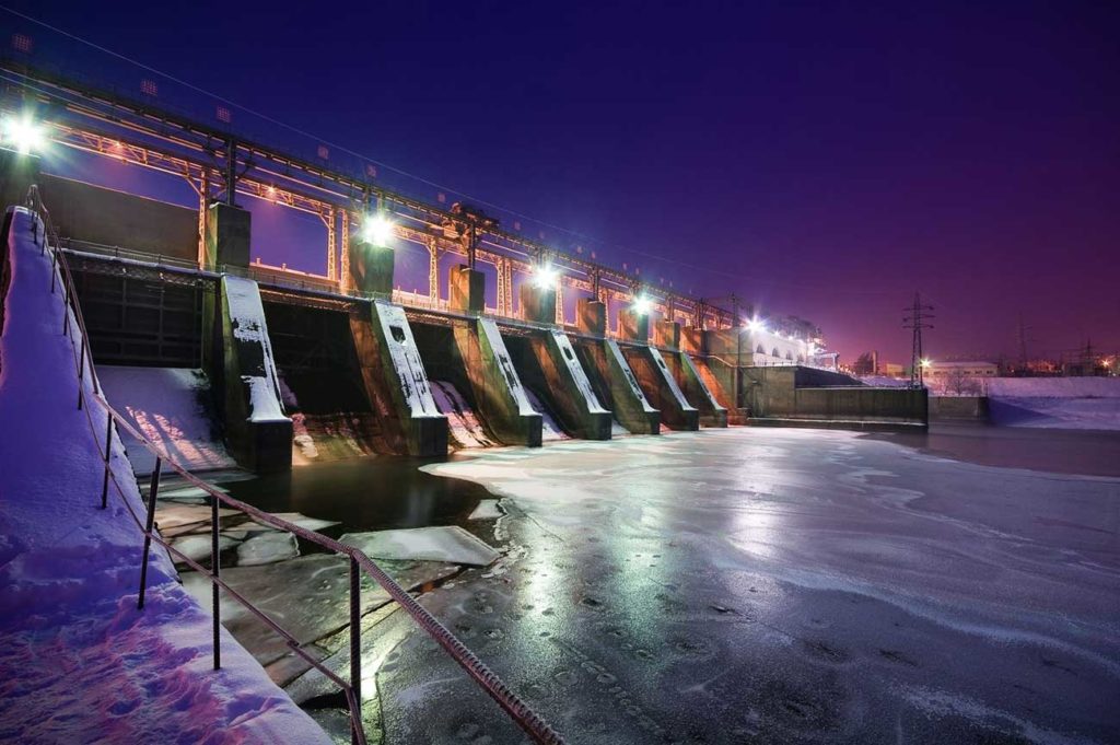
- Hydropower
- Irrigation Design
- Landslide Analysis
- Landscape Change
- Litigation Support
- Mining Hydrology
- Monitoring Subsurface
- Natural Hazards
- Pump and Treat
- Recharge Studies
- Resource Development
- Reservoir Operations
- Risk Assessment
- Seepage Studies
- Source Protection
- Streamflow and Sediment
- Surface-groundwater Interaction
- Surface-water studies
- Sustainability
- Ungaged Basins
- Unsaturated Zone
- Uncertainty Analysis
- Watershed Studies
- Water Budget
- Water Infrastructure Security
- Water Harvesting
- Water Policy
- Water-Resources Development
- Water Rights
- Water Security
[/vc_column_text][/vc_column][/vc_row][vc_row][vc_column][vc_text_separator title=”Approach”][vc_column_text]
Global Water Resource Partners is an international leader and expert on devising and implementing solutions for a wide range of water-resource challenges, whether it is for growth strategies to minimize urban flood hazards in El Salvador, a rural groundwater development project in Afghanistan, an assessment of mining effects on surface- and ground-water-quality and ecology in Romania, simulating the effects of a proposed reservoir on stream quantity and quality in China, analysis of wildfire-induced debris flows in the United States, or a commercial waste-water treatment facility in Guatemala. We are dedicated to providing unparalleled expertise in the management of water resources for rural development, industrial, and high-value uses throughout the world.
Our key disciplines are civil and geotechnical engineering, ecology, geophysics, geospatial analysis, geochemistry, hydrology, hydrogeology, supply, sustainbility, resiliency, and water security. We can provide integrated services for water-resource exploration, development, monitoring, mitigation, protection, and policy analysis throughout the world. We operate in all technical areas of groundwater and surface-water development and management involved in rural development, industry and leisure, including water-resource development programs, risk assessments for construction and civil engineering schemes and long-term water-resource management.
Our clients range from rural communities in El Salvador to multinational food and drink producers to waste-water management operators and from major engineering and construction groups to local and national governments and universities. As one of the world’s leaders in devising and implementing solutions to challenging water-resource issues, we can assure our clients of advice based on sound technical science and experience.
By combining demonstrated approaches with innovative technologies, GWRP helps clients discover, protect, and manage the water resources they need for present and future uses.
We offer comprehensive services for planning, design, supervision, and management of
a wide variety of water-resources exploration and development programs. Our firm has extensive experience investigating various hydrologic and hydrogeologic environments and has served private, municipal, and industrial clients around the globe.
Whether identifying an abundant and high-quality water supply, integrating supplies from various sources, or maximizing efficiency of existing water-distribution or commercial systems, GWRP has the knowledge and experience to ensure that our clients can most effectively use and sustain their water resources.
We use the best technology possible to develop a solution that is sustainable, whether it be the application of a basic water wheel to deliver water to a rice crop or integrating GIS to reconstruct the recent history of naturally occurring and man-induced water resources and environmental conditions, we provide a foundation for project implementation and monitor future impacts of activities in the project area. As an example, vineyard operations for papaya in El Salvador are an expanding agricultural industry. The source of water for drip irrigation is commonly provided from production water wells.
 In order to manage irrigation scheduling for optimal growth and to manage groundwater use, GWRP was retained by the University of Centroamericana to select, install, and maintain a weather station and field monitoring instrumentation set-up at vineyards near San Salvador. Reference evapotranspiration (ETo) is computed daily using meteorological parameters obtained from the weather station.
Instruments are also deployed to monitor soil moisture, soil temperature, and leaf wetness. Data recorded and displayed in real-time are used to develop a water budget. Using ETo and soil and plant monitoring data, an irrigation scheduling strategy, and the concept of partial soil-water deficit irrigation, a best irrigation management practice is being implemented for optimal production.
Regardless of the water issue, GWRP has the solution that is right for you; a solution that is sustainable, effective, and that returns value to your community or organization.[/vc_column_text][/vc_column][/vc_row][vc_row bg_type=”bg_color” css=”.vc_custom_1508174432583{margin-bottom: 25px !important;padding-top: 25px !important;padding-right: 25px !important;padding-bottom: 25px !important;padding-left: 25px !important;}” bg_color_value=”#eeeeee”][vc_column][vc_text_separator title=”Business Development & Execution”][vc_column_text]A continually changing landscape due to anthropogenic sources, whether it be rural development or urbanization can often cause significant interactions between surface- and ground-water that are complex and often unique to the specific location or circumstances. These complexities frequently result in significant technical challenges, whether for rural development or commercial water uses.
GWRP has the strong technical background, reputation, and analytical tools necessary to evaluate, document, and depict these water issue relationships. Whatever the problem we can apply the most advanced technological capacity necessary to obtain a solution.
GWRP employs a number of methods to investigate surface- and ground-water interactions. We can design, install, and maintain automated data acquisition systems for stream discharge and groundwater level monitoring. We can also establish and operate networks to provide data on the chemical quality of surface water and groundwater.
By analyzing the relations between rainfall and runoff, as well as examining groundwater level response in different parts of the aquifer system, we can evaluate natural conditions and the impact of development activities on surface water and groundwater. These components can be combined to determine the overall water budget of the system, both locally and regionally. GWRP can also help clients navigate the issues of water rights adjudication and assist with relevant water rights permits.
As an example of technology and it uses, GWRP uses the latest techniques in GIS and satellite imagery processing and analysis to monitor past and present relations between land uses and water resources, which is particularly beneficial in rural development and urbanization issues. Satellite images can be used to accurately distinguish and measure surface features to a high resolution and are particularly useful in areas where ground access due to remoteness or topography is impractical.
By using satellite imagery to examine and measure surface water features, the extent and health of vegetation, and geologic features, we offer a cost-effective method for investigating large project areas for any water-development issue. Using our hydrogeologic expertise as a strong foundation, we continue to incorporate innovative approaches and develop new applications to provide clients with valuable solutions.[/vc_column_text][/vc_column][/vc_row]